FRP HWY 101
GOLD
The following Property is available for sale or option.


FRP Hwy 101 Gold Property
____________________
Frecheville Township
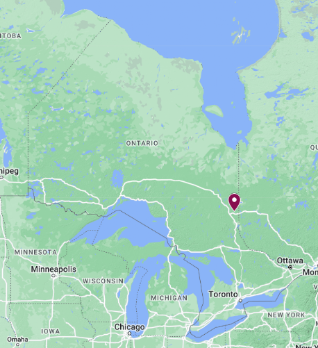
Near Kirkland Lake, Ontario
Near Kirkland Lake, Ontario
23 claim cells adjacent to Agnico Eagle (former Kirkland Lake Gold) Holt & Holloway Mines along Hwy 101


The FRP Hwy 101 Gold Property, which consists of 23 contiguous claims in central Frecheville Township numbered 543788- 543810 and is held by F. R. Ploeger, is located approximately 120km east of Timmins and 52km northeast of Kirkland Lake. It is situated north of Highway 101 between Matheson and Duparquet approximately 10km east of the junction with Hwy 672 and is accessed via a network of old logging roads that traverses the property. The FRP Gold Property is tied on to the Agnico Eagle (formerly Kirkland Lake Gold Inc) property about 5 km northeast of the Holt and Holloway Mines.

· On the NORTH BRANCH of the PORCUPINE DESTOR DEFORMATION ZONE (PDDZ);
Apart from geological mapping by the Ontario Geological Survey, little exploration or assessment work has beenrecorded for the claim group prior to 1985. During the course of the fieldwork, there was no evidence of earlier prospecting activity, such as trenching or pitting. However, the extensive logging of the area may have obscured some of the potential features. Presumably, the area was explored for gold following the discovery of the spectacular gold at the Croesus Mine in 1914 and for base metals after the Kidd Creek discovery. No significant exploration activity was conducted on the property following the commencement of mining at the Holt and Holloway mines.
The FRP Gold property straddles the North Branch of the Porcupine Destor Deformation Zone (PDDZ) as projected by the OGS (Ayer, Berger & Trowell, 1999). Prospecting on the property by the claim holder in 2021 and 2022 confirmed the interpreted geology with massive and pillowed mafic volcanic flows (possibly ultramafic) to the north and intermediate to felsic flows and tuffs in the central area and the south. The central area through which the PDDZ is projected is extensively covered with glaciolacustrine clay and sand, with very few outcrop exposures.
· Very limited historic drilling (4 holes by Lacana Mining);
· Anomalous gold values to 300ppb over significant widths, including FR88-03: 235 ppb Au/ 30 ft from 186-216 ft & 176 ppb Au/ 60.0 ft from 506- 566 ft;
· Drilling and mapping indicate strong sericite, silica, carbonate, pyrite and albite(?) alteration;
Only 4 holes have been drilled on the property, according to research into the Kirkland Lake Resident Geologist’s assessment files. These holes were drilled by Lacana in 1988; however, assays were provided for only 2 of the holes (FR88-3 & 4). The holes were originally located on the Lacana grid, but the area has been clear-cut since they were drilled and, therefore, could not be accurately located.
The 4 holes intersected a package of altered felsic to intermediate flows and fragmentals and local thick sections of porphyritic dacite containing up to 40% pyrite interbedded with graphitic argillites. The higher anomalous gold values were almost exclusively associated with the well-altered felsic to intermediate volcanic flows and pyroclastics. Generally, the graphitic argillites were not sampled.
Hole FR88-1 intersected a sequence of fine felsic pyroclastics interbedded with graphitic argillite and pyritic mudstones containing lenses of 80% pyrite while FR88-2 cut a unit of felsic agglomerate and porphyritic dacite with local zones and interbeds of argillite. No assays are provided in either log; however, for the remaining two holes, the assays are given. Hole FR88-3 was collared in well-bedded, moderately graphitic argillite and ended in altered felsic tuffs and andesite flows, the latter which returned 235 ppb Au over 30 ft from 186-216 ft & 176 ppb Au over 60.0 ft from 506- 566 ft.
The graphitic horizons were generally not sampled. Therefore, the anomalous gold values were associated with the intermediate to felsic volcanic. This suggests that gold is associated with altered volcanics similar to the Holt and Holloway mines and there could be a strong alteration system accompanied by significant gold mineralization associated with the north branch of the PDDZ.

· OGS basal till sample south of projected PDDZ ran 440ppb Au;
According to the location map, sonic drill hole 88- 16 was collared immediately south of the Lightning River near the west central boundary of current claim 543805. It was drilled to a depth of 40.8m in overburden, and continued in bedrock to 43.0m in altered intermediate volcanic. The “H” fraction (-10 mesh) of the heavy mineral concentrate contained 440 ppb gold.
· Complex VLF-EM Fraser filter patterns around a central strong conductive horizon: Mag & VLF indicate a strong fault
Canadian Exploration Services (CXS) was contracted to conduct magnetometer and VLF-EM surveys on the FRP Hwy 101 Gold property in June 2022. CXS has compared their survey lines to 2003 airborne survey plans generated by the OGS as displayed in the accompanying figures. Red triangles represent outcrops located during prospecting; the blue dashed line is the location of the North Branch of the Porcupine Destor Deformation Zone as taken from the OGS geological map.

The mag survey correlates well with the OGS airborne mag survey. However, the overburden cover extends across the transition from low to high mag signature and the line of airborne conductors. During the 2021 & 2022 prospecting traverses by the claim holder, a series of outcrops of mafic (possibly ultramafic) volcanics was mapped at the north (top) end of the 6th CXS survey line from the west (L1600E) and intermediate/ felsic volcanics to the south and west as indicated by the red triangles on the figures.
While surveying the claims, the CXS geophysical crew was asked to document the location of any outcrop exposures for follow up prospecting, however, there were no outcrops reported over the entire survey area.

The OGS airborne EM anomalies form two distinct linear trends which appear to join around the middle of CXS lines 7 and 8 (1900E & 2200E). The northern crossovers are interpreted by CXS to “indicate a geological contact, strong structure or mineralized/ graphitic system”. The “Central signature” does not appear to coincide with either of the airborne EM anomaly traces. The CXS report notes that “the strong nature of the central VLF-EM signature indicates a strong conductive system…. such as a graphitic argillite.” It also observes that there are numerous smaller crossovers on all of the survey lines. The multitude of VLF anomalies are, in part, related to graphitic lenses, but also may reflect increases of up to 60% pyrite in the felsic/ intermediate volcanics and intrusives. According to the two drill logs in which assays are provided, almost all of the anomalous gold assays occur exclusively within these felsic/ intermediate volcanics and intrusives.
NOTE: A second ground magnetometer and VLF-EM survey has been completed, infilling the lines where the airborne anomalies merge and also extending all the lines to the south claim boundary.